Scientific paper has been published
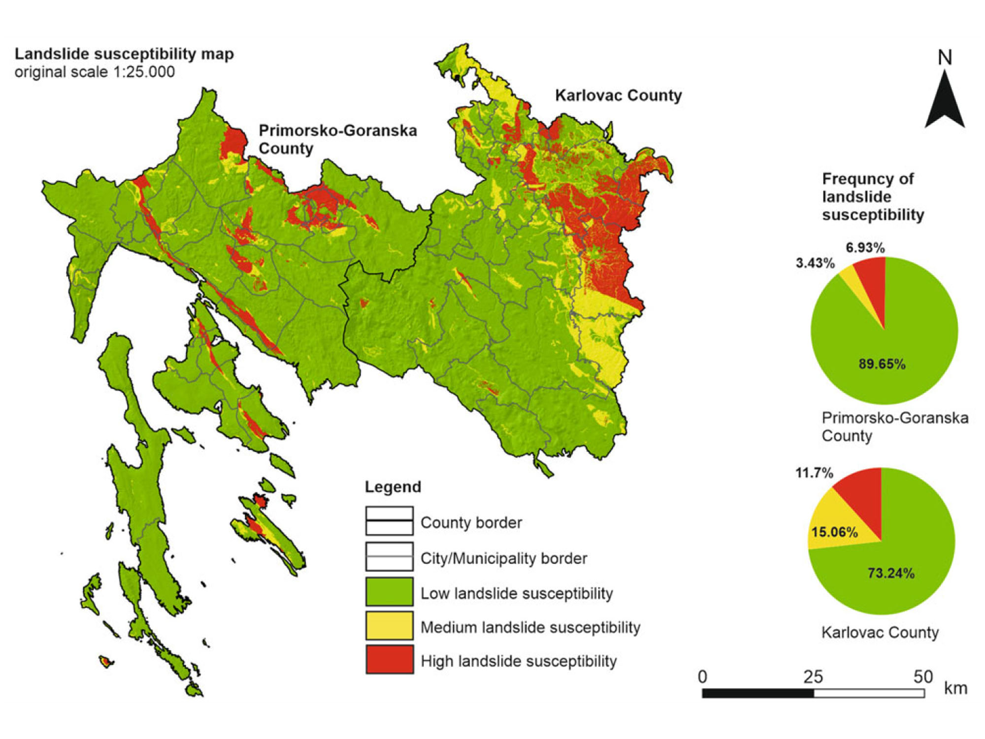
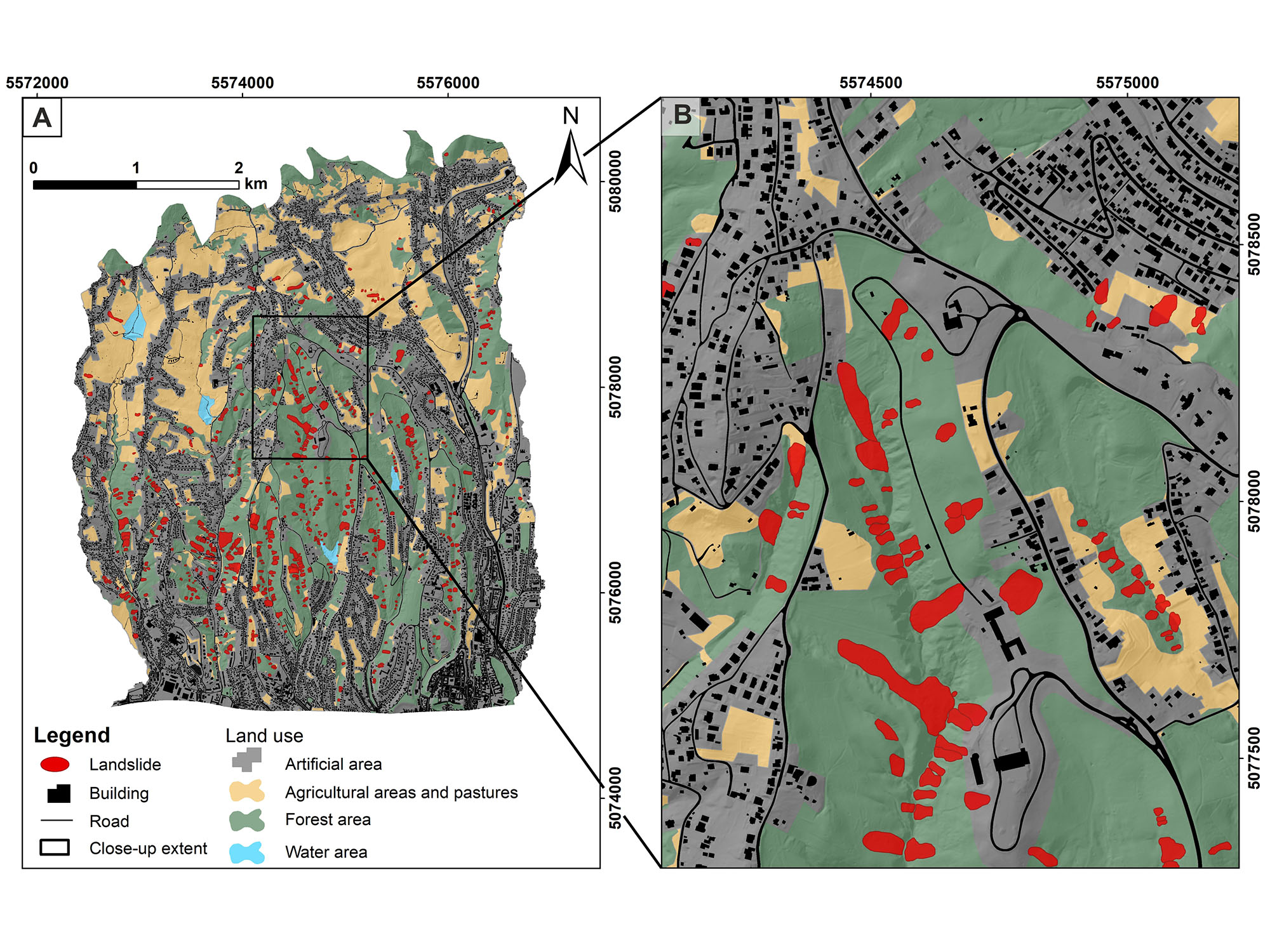
The seventh paper, created as part of the LandSlidePlan project, named “Landslide Detection and Spatial Prediction: Application of Data and Information from Landslide Maps” has been published in the book “Progress in Landslide Research and Technology” by the International Consortium on Landslides. The authors of the paper are Snježana Mihalić Arbanas, Sanja Bernat Gazibara, Martin Krkač, Marko Sinčić, Hrvoje Lukačić, Petra Jagodnik and Željko Arbanas. The paper presents the types of data and information about landslides that can be obtained from landslide inventory maps and the types of data and information which can be obtained from landslide susceptibility maps. Based on the data analysis, the landslide susceptibility maps were prepared on a small scale (national level), medium scale (county level) and detailed scale (city/municipality). The research demonstrates the need for a hierarchical approach, starting with analyses on a small and medium scale, followed by analyses on a detailed scale. The paper also emphasises the application and utility of detailed landslide susceptibility maps produced from remote sensing data.


