Published journal paper Jagodnik et al. in the Journal of Maps
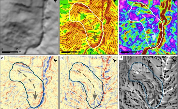
In the Journal of Maps the first article made within the LandSlidePlan project was published, entitled “Engineering geological mapping using airborne LiDAR datasets – an example from the Vinodol Valley, Croatia” by Petra Jagodnik, Sanja Bernat Gazibara, Željko Arbanas and Snježana Mihalić Arbanas. The article presents the possibilities of using a digital elevation model (DEM) made by laser airborne scanning (technique known as LiDAR) for engineering geological mapping in geologically complex areas covered by forest cover.
The paper presents eight sets of topographic data derived from 1-meter DEM for the purpose of visual interpretation of multiple types of geological data, rock types, and active geomorphological processes, landslides, and erosion. This research is the preliminary research for the LandSlidePlan project because it indicates the possibilities of using different sets of topographic maps to identify landslides in terrains built of flysch rocks in which erosion processes are present, such as the pilot area in the City of Buzet. The described procedures for visual identification of landslides in the area of the Vinodol valley (surface area 16.75 km2) resulted in an inventory containing more than 500 landslides. The paper presents the mutual spatial relationship between landslides and erosion, which significantly affects the research methodology in the LandSlidePlan project, due to the need to visually map the occurrence of erosion in the pilot area in Istria.

